Hawaii is still one of the most-searched tropical destinations on Google. These 15 photographs cover Kauai, Oahu, Maui, and the Big Island — cliffs, volcanoes, black sand, and water so clear it looks edited. Every image is used with a free license. Credit sits under each photo.
1. Nā Pali Coast, Kauai
Sheer green cliffs drop into the Pacific along Nā Pali Coast State Park. This is the postcard most people picture when they search Hawaiian islands.
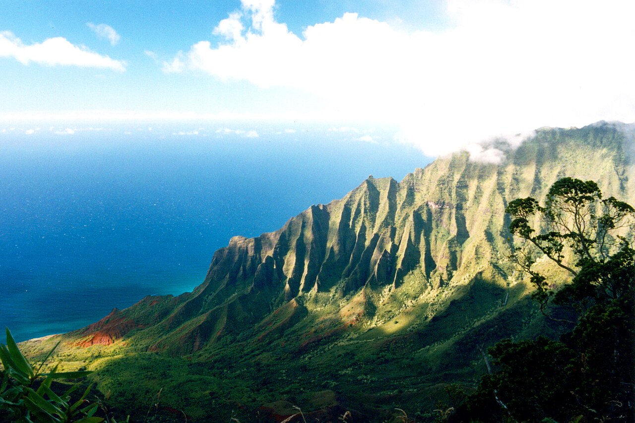
Photo: Jeff Kubina / Wikimedia Commons / CC BY-SA 2.0
2. Waimea Canyon, Kauai
Nicknamed the Grand Canyon of the Pacific, Waimea Canyon cuts more than 3,000 feet through red volcanic rock and rainforest.

Photo: dronepicr / Wikimedia Commons / CC BY 2.0
3. Haleakalā Sunrise, Maui
Watching sunrise from the summit of Haleakalā National Park is a Maui ritual. The crater looks like another planet until the light hits it.

Photo: Melissa Doroquez / Wikimedia Commons / CC BY-SA 2.0
4. Lanikai Beach, Oahu
Soft sand, turquoise water, and the two Mokulua islets offshore. Lanikai is small, residential, and consistently ranked among America's best beaches.

Photo: R. Sullivan / Wikimedia Commons / CC BY-SA 3.0
5. Hanauma Bay, Oahu
A flooded volcanic crater turned nature preserve. The reef is protected, snorkel numbers are capped, and the water stays a sharp blue-green.

Photo: Dave Gingrich / Wikimedia Commons / CC BY-SA 2.0
6. Diamond Head, Oahu
Honolulu's volcanic tuff cone is the city's landmark. The short crater hike ends with a view of Waikiki and the south shore.

Photo: Robert Linsdell / Wikimedia Commons / CC BY 2.0
7. Waikiki Beach, Oahu
The most famous beach in Hawaii, with Diamond Head in the frame. Early morning is when the sand is empty enough to actually see it.

Photo: Frank Schulenburg / Wikimedia Commons / CC BY-SA 4.0
8. ʻAkaka Falls, Big Island
A 442-foot waterfall in a rainforest on Hawaii's Hamakua Coast. The loop trail is short; the drop is not.

Photo: HonomuGoatGuy / Wikimedia Commons / CC BY-SA 4.0
9. Mauna Kea, Big Island
The highest point in Hawaii, often snow-capped in winter. Observatories sit on the summit above the clouds.
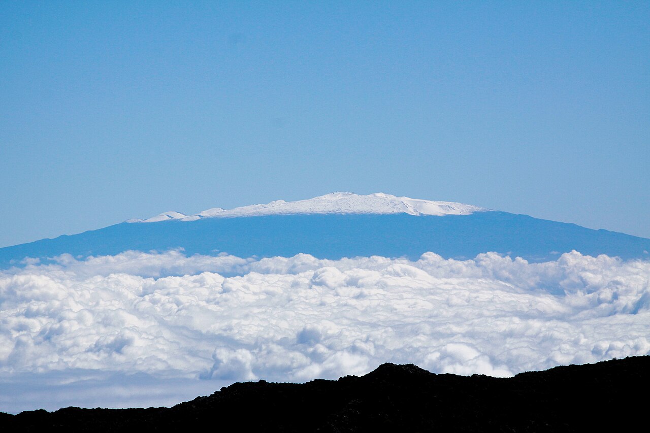
Photo: Aiden Relkoff / Wikimedia Commons / CC BY-SA 4.0
10. Molokini Crater, Maui
A crescent-shaped islet off Maui and one of the state's best snorkel sites. The crater wall shelters calm, clear water.

Photo: Collin Grady / Wikimedia Commons / CC BY-SA 2.0
11. Pololū Valley, Big Island
Black sand, steep walls, and a lookout at the end of Highway 270. Pololū feels older and quieter than the resort coast.

Photo: Mickaw2 / Wikimedia Commons / Public domain
12. Waipiʻo Valley, Big Island
A deep valley of taro fields and a river mouth beach, seen from the Kukuihaele lookout. Access to the valley floor is restricted for a reason.

Photo: Famartin / Wikimedia Commons / CC BY-SA 4.0
13. Hanalei Bay, Kauai
A wide crescent on Kauai's north shore, mountains behind, rain sometimes moving in over the water. Surf in winter, glass in summer.

Photo: tdlucas5000 / Wikimedia Commons / CC BY 2.0
14. Kīlauea Lava, Big Island
Pahoehoe lava from Kīlauea is why Hawaii Island is still growing. When the volcano is active, this is one of the few places on Earth you can watch land form.

Photo: Brocken Inaglory / Wikimedia Commons / CC BY-SA 3.0
15. Punaluʻu Black Sand Beach, Big Island
Volcanic sand, coconut palms, and green sea turtles that haul out to rest. Stay back from the turtles — the photo still works from the path.

Photo: Diego Delso / Wikimedia Commons / CC BY-SA 3.0
All 15 photos are from Wikimedia Commons. If you republish, keep the photographer credit and license link under each image.


.jpg)


_(20808316082).jpg)
-L1004709.jpg)


.jpg)


No comments:
Post a Comment